Hydrological & Hydrogeological Surveys by FORAGEO
FORAGEO provides end‑to‑end hydrological and hydrogeological survey services to support reliable water supply development, infrastructure design, environmental compliance, and flood risk management.
Hydrological & Hydrogeological Surveys by FORAGEO
FORAGEO provides end‑to‑end hydrological and hydrogeological survey services to support reliable water supply development, infrastructure design, environmental compliance, and flood risk management.
Core Capabilities
- Groundwater Exploration – Integrated geophysical surveys, exploratory drilling, and pumping tests to locate aquifers, estimate sustainable yields, and evaluate water quality.
- Aquifer Testing & Characterization – Design and execution of pumping and recovery tests to determine transmissivity, storativity, specific yield, and hydraulic conductivity for water supply design and groundwater modeling.
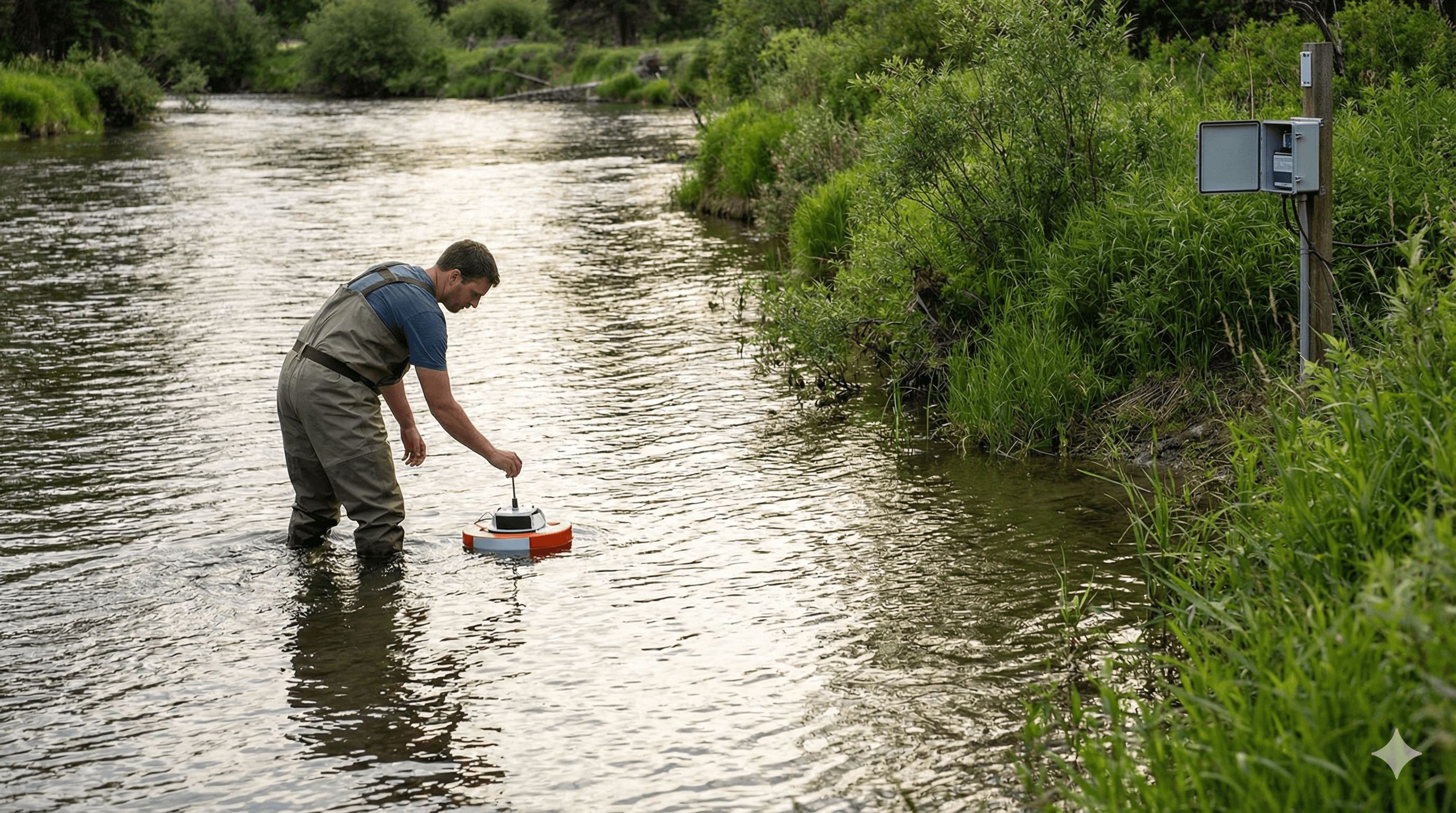
- River & Stream Flow Measurement – High‑accuracy discharge measurements using ADCP, velocity‑area methods, and rating curves to support water resource assessments, flood studies, and environmental flow analysis.
- Groundwater Level Monitoring – Design, installation, and operation of monitoring networks with automated loggers to track seasonal water table changes and long‑term trends.
- Flood Risk Assessment – Catchment hydrology analysis, rainfall‑runoff modeling, flood frequency estimation, and hydraulic modeling to inform drainage design and flood mitigation.
Methods & Technology
- Geophysical methods (e.g. electrical resistivity tomography, EM surveys) integrated with targeted drilling and well installation to build robust conceptual hydrogeological models.
- Surface water surveys using boat‑mounted and wading ADCP systems, calibrated current meters, and automated level recorders to capture both baseflow and event‑driven conditions.
- Advanced analytical and numerical tools for pumping test interpretation, rainfall‑runoff modeling, groundwater flow simulation, and flood routing.
- Clear, decision‑focused reporting with full data appendices, interpreted results, and practical, regulation‑aligned recommendations.
Key Applications
- Water Supply Development – Wellfield siting and design, sustainable yield assessment, and source protection zoning for municipal, industrial, and agricultural users.
- Construction & Infrastructure – Dewatering feasibility, groundwater control design, and assessment of construction impacts on local water resources.
- Environmental Assessment – Baseline characterization, impact assessment, and compliance monitoring for water quantity and quality.
- Flood Management – Catchment studies, flood mapping, SuDS support, and climate‑change‑informed flood frequency and magnitude analysis.
- Mining & Quarrying – Mine water management, pit dewatering, acid mine drainage assessment, and post‑closure monitoring.
Why FORAGEO
- Integrated groundwater and surface water expertise covering the full hydrological cycle.
- Experienced field teams capable of working in both water‑scarce and flood‑prone environments.
- Extensive in‑house monitoring equipment for rapid deployment and adaptable survey programs.
- Strong emphasis on data quality, transparent communication, and actionable recommendations that align with client objectives and regulatory requirements.
Discuss your project’s water resource, flood risk, or monitoring requirements with FORAGEO’s hydrology team. We will help you define an appropriate survey scope, select the right methods, and develop a clear, cost‑effective investigation and monitoring strategy tailored to your site and regulatory context.