FORAGEO Geophysical Survey Services
FORAGEO provides comprehensive, non-invasive geophysical surveys to image subsurface conditions with high resolution and reliability. Using advanced instrumentation and tailored survey designs, we support projects ranging from foundation assessment and infrastructure planning to mineral exploration and environmental investigations.
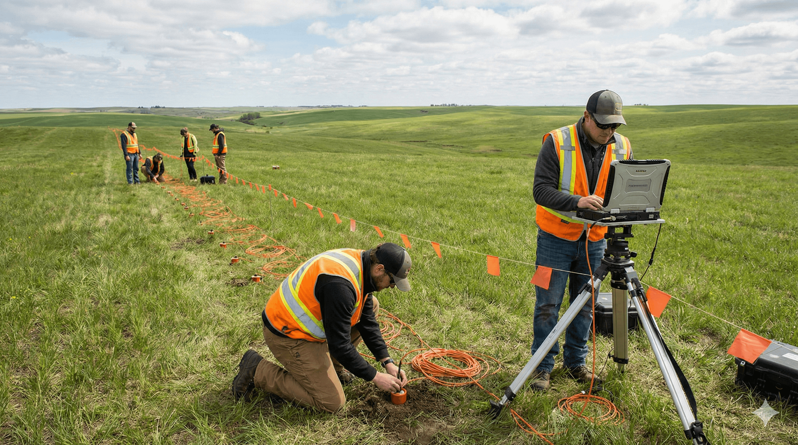
Survey Methods
- Seismic Refraction & Reflection – Determine bedrock depth, layer thickness, and material stiffness for rippability assessment, foundation characterization, and mapping geological interfaces.
- Ground Penetrating Radar (GPR) – High-frequency EM imaging of shallow subsurface features such as buried utilities, voids, concrete reinforcement, and archaeological targets, typically to depths of up to ~30 m (site-dependent).
- Electrical Resistivity Tomography (ERT) – 2D/3D resistivity imaging to delineate geological boundaries, groundwater zones, and contamination plumes.
- Electromagnetic (EM) Surveys – Frequency- and time-domain EM for rapid conductivity mapping, detection of metallic objects, and delineation of contamination boundaries.
- Magnetic Surveys – Mapping variations in the Earth’s magnetic field to locate ferrous objects, identify geological contacts, and characterize subsurface structures.
Data Processing & Interpretation
All datasets undergo rigorous processing and quality control, including noise filtering, topographic corrections, velocity analysis, and inversion modeling. Senior geophysicists integrate geophysical results with geological information and borehole data to produce clear 2D profiles and 3D subsurface models. Deliverables include:
- Methodology and acquisition parameters
- Data quality assessment and processing workflow
- Interpreted cross-sections and models
- Practical recommendations for design and construction
Key Applications
- Site Investigation – Pre-construction ground characterization, bedrock profiling, and anomaly detection for buildings, bridges, and infrastructure.
- Utility Detection & Mapping – Non-destructive mapping of buried pipes, cables, tanks, and other services prior to excavation.
- Groundwater Exploration – Identification of aquifers, water table mapping, and groundwater flow assessment for well siting and resource management.
- Environmental Assessment – Delineation of contamination plumes, buried waste detection, and monitoring of remediation.
- Mining & Quarrying – Mineral targeting, overburden thickness estimation, and rock quality assessment for quarry and mine planning.
Why Partner with FORAGEO
FORAGEO combines experienced geophysicists, a versatile equipment fleet, and integrated interpretation workflows to deliver reliable ground models that reduce project risk. By correlating geophysical results with borehole and geological data, we provide actionable insights with fast turnaround and clear, accessible reporting for both technical and non-technical stakeholders.